D1800 Drone - 20KG Payload 60 Minutes 10KM Distance Industrial Drone
-
Detail
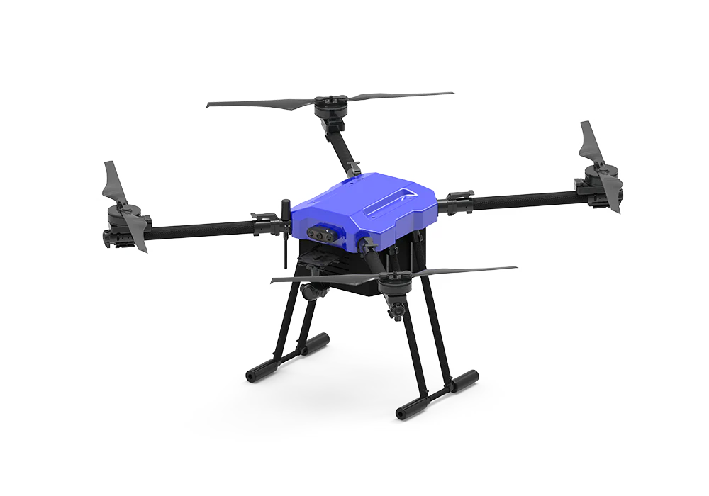
D1800 Drone Overview
The D1800 Drone is an advanced engineered for demanding inspection and mapping tasks. Featuring a substantial 20kg payload capacity, a no-load flight time of up to 60 minutes, and a remarkable control distance of 10km, the D1800 Drone is designed to deliver superior performance and reliability. Constructed with aviation aluminum alloy and carbon fiber, it offers a perfect balance of strength and lightweight efficiency. With a maximum flight altitude of 5000 meters and a top speed of 20m/s, this drone is ideal for comprehensive and detailed inspections.
Note:
This drone needs to be customized, do not pay directly, we will not ship it. Please send an email to buysom2022@gmail.com first.
D1800 Drone Key Features:
High Payload and Endurance: The D1800 Drone can carry up to 20kg, making it suitable for a wide range of inspection equipment. It offers a no-load flight time of 60 minutes, ensuring long operational periods without the need for frequent recharges. The robust 40000mAh battery provides dependable power for extended missions.
Extended Control Range: The drone's maximum control distance of 10km in open areas without electromagnetic interference enables extensive coverage, essential for large-scale inspection and mapping tasks.
Advanced Flight Capabilities: Capable of ascending and descending at speeds of up to 5m/s and achieving a maximum flight speed of 20m/s in no-wind conditions, the D1800 Drone is designed for efficient operations. It can withstand winds up to Level 7, ensuring stability in various environmental conditions. The maximum flight altitude of 5000 meters allows for high-altitude inspections.
Precision Hovering: The D1800 Drone features advanced GPS/GLONASS/BDS/Galileo satellite positioning modules, ensuring hover accuracy with a vertical deviation of ±0.5m and a horizontal deviation of ±1m. This precision is crucial for detailed inspection tasks.
4K HD Camera: Equipped with an HD 4K camera with 10/30 times zoom capabilities, the D1800 Drone captures high-quality aerial footage, ideal for detailed inspections and mapping projects. This allows for close-up inspections without the need for proximity.
D1800 Drone Versatile Applications:
The D1800 Drone excels in a variety of applications, including:
Infrastructure Inspection: Efficiently inspect bridges, towers, and pipelines. The drone's high payload capacity and long flight time enable thorough inspections without multiple trips.
Mapping and Surveying: Generate detailed maps and conduct land surveys with the integrated high-definition camera and advanced positioning systems. The extended control range ensures comprehensive area coverage.
Environmental Monitoring: Monitor vast areas for environmental changes, wildlife tracking, and conservation efforts. The drone's ability to operate in various weather conditions makes it ideal for outdoor monitoring.
D1800 Drone Specifications:
Parameter Specification Fuselage Dimensions 1800mm x 1800mm x 800mm Folding Dimension 650mm x 700mm x 800mm Wheelbase 1650mm Material Aviation aluminum alloy, carbon fiber Body Weight 14KG Maximum Takeoff Weight 40kg (near sea level) Maximum Load 20kg Maximum Ascent Speed 5m/s Maximum Descent Speed 5m/s Maximum Wind Resistance Level 7 Maximum Flight Altitude 5000m Maximum Flight Speed 20m/s (no wind environment) No-load Flight Time 60 minutes Maximum Control Distance 10km (open without shelter, no electromagnetic interference) Maximum Flight Climb Altitude 1000m Hover Accuracy Vertical: ± 0.5m (when GPS positioning is working normally)<br>Horizontal: ± 1m (when GPS positioning is working normally) Satellite Positioning Module GPS/GLONASS/BDS/Galileo Camera HD 4K quality with 10/30 doubling Power System Integrated FOC power system Working Temperature -20℃ to 50℃ Waterproof Grade In the rain, the fuselage can be flushed with water Battery Capacity 40000mAh Hand-held Ground Station Operating Frequency 2.4GHz & 5.8GHz Dual Band Chip Surging S1 System Android Signal Effective Distance About 10km (open without shelter, no electromagnetic interference) Video Output Interface HDMI/Wi-Fi Built-in Battery 7.4V 20000mAh LiPo2S Endurance 20 hours Display 7 inch screen, resolution 1920*1200, Brightness 2000cd/㎡ Memory Card Type Maximum support for 128GB capacity microSD card Integrated Operation Page Flight parameters integration, image map can be switched at will Voice Broadcast With adjustable real-time voice broadcast Note: All the above product parameters are subject to modification based on different customer needs for mounting equipment without further notice!
Invest in the D1800 Drone for your industrial inspection and mapping needs to experience unmatched performance, reliability, and efficiency.
-
Customer ReviewsNo comments